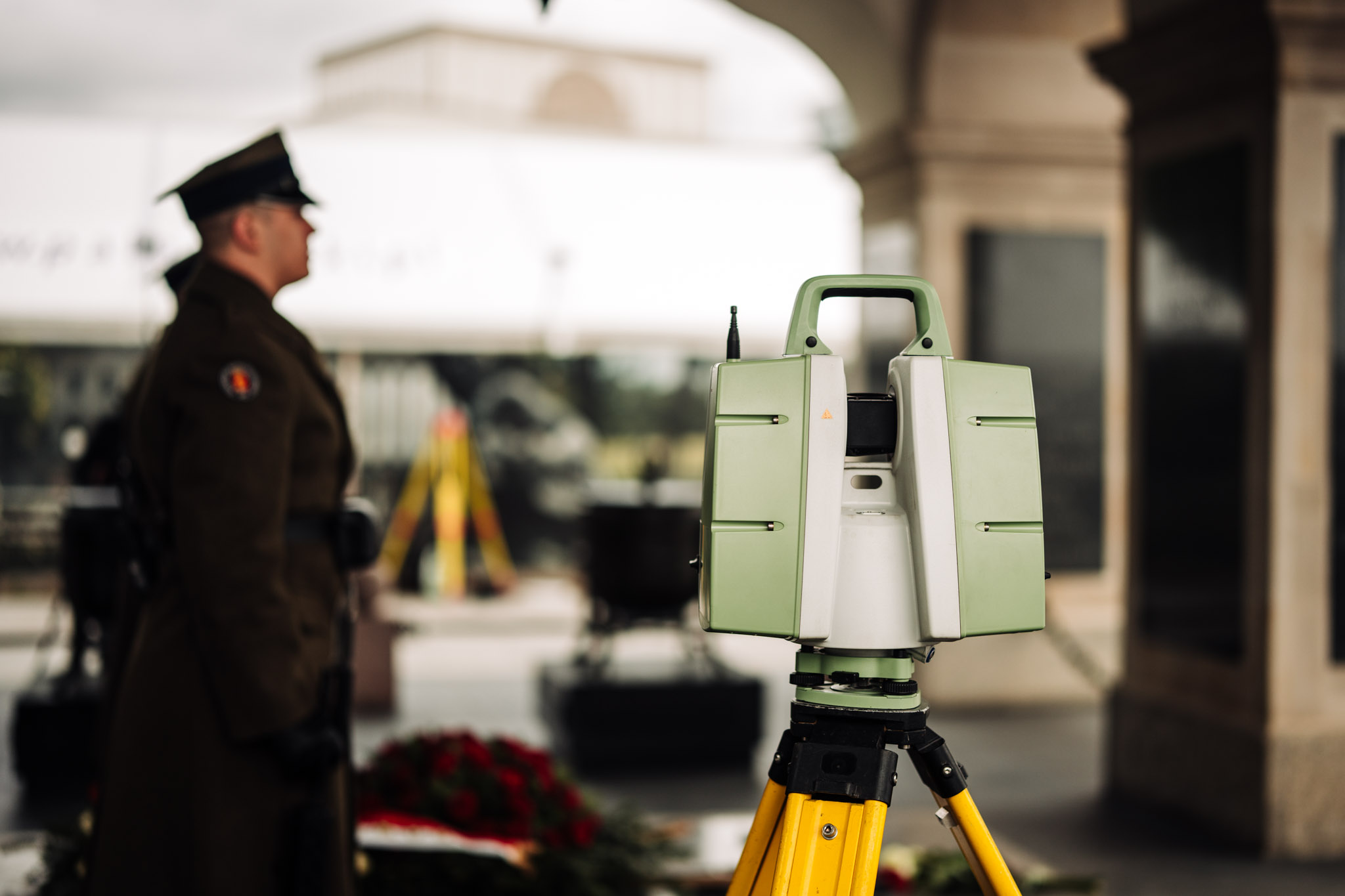
Geodetic monitoring of the Tomb of the Unknown Soldier
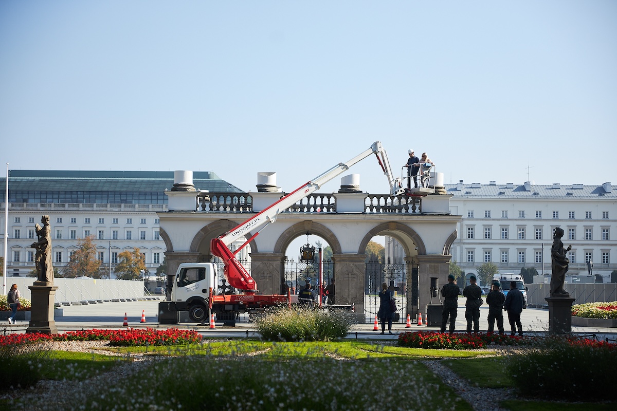
Not all of the reconstruction works on the western frontage of Piłsudski Square are as spectacular as the construction of a roofing over the relics of the Saski Palace listed in the register of monuments. Such activities, which are necessary during the preparation of the investment, although not noticeable to most outsiders, include geodetic monitoring of the Tomb of the Unknown Soldier.
What is geodetic monitoring?
Geodetic monitoring is a method of observing a given structure or facility by conducting systematic measurements and then completing a detailed analysis. In the case of the process of rebuilding the Saski Palace, this is how we are inspecting the historic site of the Tomb of the Unknown Soldier. As a result, a section of the palace arcade, which has housed the most important national memorial for almost a century, is being monitored for the potential impact of the works conducted nearby.
Monitoring of the Tomb of the Unknown Soldier
Geodetic monitoring and its ongoing analysis are used to assess the impact of nearby archaeological and conservation works, and ultimately also construction works, on the Tomb of the Unknown Soldier. For this purpose, laser scanning was used, which enables the overall capture of the monitored object in the field. The first session, i.e. zero measurement, was carried out on 26 July 2022, before the project area was fenced off and the groundworks started. Three months later, after the unveiling of the relics of the Saski Palace in the area of the Tomb of the Unknown Soldier, the first comparative session took place. The repeated 3D scan of the monument was linked to the previously established geodetic network, i.e. a set of 20 points in the area around Piłsudski Square. Some of these points include reflective survey targets on surrounding buildings and lampposts, as well as survey nails permanently driven into the ground.
By comparing the measurement results from the zero session and the results from subsequent measurement sessions, it is possible to determine even the smallest (considering measurement errors) changes in the object’s geometry (i.e. its deformations - displacements) and thus also the consequences of these displacements, such as the enlargement of cracks.
Historical cracks in the vault
Like almost every historical monument, the arcades of the Tomb of the Unknown Soldier also bear slight traces of the passing of time. Given the history of the building, the company is also monitoring pre-existing cracks in its vault. Their measurements were taken using the photogrammetric method, for which a camera with a full-frame sensor was used. In short, a series of photographs, known as photograms, were taken and used for spatial measurements. Photographs taken from different viewpoints and then collated together allow a faithful reproduction of the space under analysis. In this way, the data collected made it possible to confirm down to the millimetre that the width of the cracks is not increasing, which means that the works carried out by the company do not have an adverse effect on the Tomb of the Unknown Soldier.
Works at the Tomb of the Unknown Soldier
Geodetic monitoring of the Tomb of the Unknown Soldier is not the only example of works undertaken at this place. In September 2022, at the request of the Pałac Saski company, petrographic tests of the columns located above the monument were carried out. Samples from the bases of two of them were subjected to stone analysis to reflect as closely as possible the materials from which the palace colonnade was constructed.